Annular Solar Eclipse of 2013 May 10
Introduction
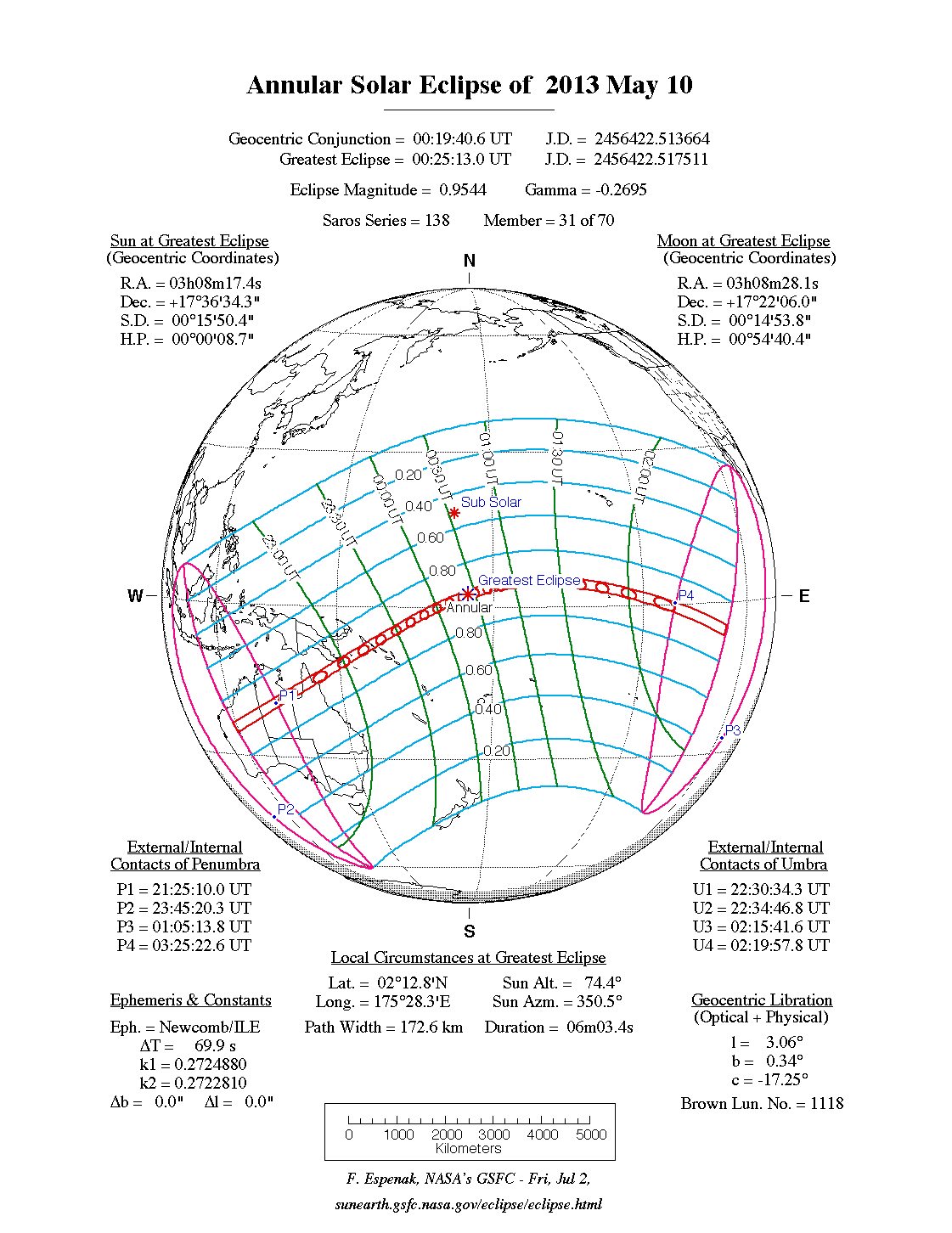
This map shows the path of the Annular Solar Eclipse of 2013 May 10 . The northern and southern path limits are blue and the central line is red. The yellow lines crossing the path indicate the position of maximum eclipse at 10-minute intervals. The four-way toggle arrows (upper left corner) are for navigating around the map. The zoom bar (left edge) is used to change the magnification. The three buttons (top right) turn on either a map view, a satellite view or a hybrid map/satellite view
Google Maps and Solar Eclipse Paths
 |
| annular solar eclipse 2013 |
 |
| annular solar eclipse 2013 |
The green marker labeled GE is the point of Greatest Eclipse. Click anywhere on the map to mark a position and calculate the eclipse times there. Move the cursor over a marker to reveal the eclipse circumstances for that position. The marker predictions can also be viewed in a new window via the Eclipse Times Popup button. You can select and copy this infomation to paste into a word processor. All markers can be removed using the Clear Markers button above. Choose the Large Map check box to produce a bigger map (for users with large monitors and fast internet connections). For more information, see Google Eclipse Map Instructions
.